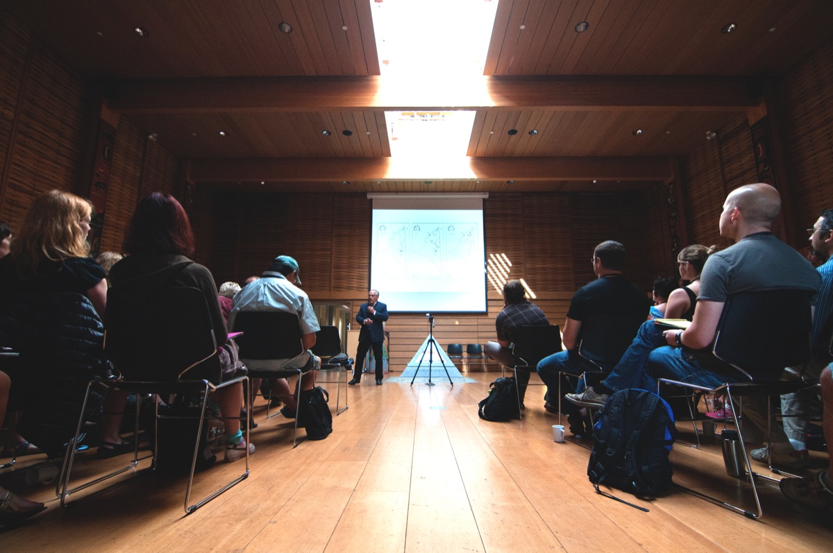
Terry Tobias leads a workshop on Aug. 26 on land use and occupancy studies in the First People’s House. –Hugo Wong(photo)
Over 100 mapping professionals and representatives from Indigenous organizations came together for a mapping workshop hosted by UVic from Aug. 25 to 28.
In partnership with The Firelight Group and Google Earth Outreach, representatives involved in the land, water, and resource mapping of Indigenous people were able to share knowledge with workshop attendees. The busy agenda included individual presentations and information sessions on mapping traditional land use, environmental monitoring, inter-generational knowledge, and much more.
Attendees learned about the most accurate and effective Indigenous mapping practices to add evidence in litigation settings, and keep a close eye on the rich history of Indigenous lands.
Grand Chief Stewart Phillip, president of the Union of British Columbia Indian Chiefs, who first became involved in Indigenous issues 40 years ago, gave the opening address for the workshop.
“Quite often when we speak publicly about the interest of the people, and the impact of resource development, it’s not clearly understood by the general public. But there’s one thing that can really capture the attention and imagination of all people—and that’s a map,” Phillip said during the address.
Phillip admits that the evolution of technology in the last 40 years has been of great importance for the Indigenous peoples who are at the forefront of the conflict, defending their lands in remote locations.
“Our elders often remind us that our history is written on the land. With the technology that we have today, and the great urgency attached to the fact that when we move forward into the future, many of our knowledge keepers are passing away, it is absolutely urgent and critical that we document the history of our presence.”
Phillip is grateful to have witnessed the transformative change in the last 40 years, and stressed the importance of a map in courtrooms and litigation, and in all dialogues on Indigenous rights.
According to Raleigh Seamster, Google Earth Outreach Program Manager, the search giant’s mapping tool provides an easy visual aid. “People have a kind of geo-literacy with Google Earth that makes it easy for people to explore and understand the [Indigenous land dispute] issue that you’re trying to explain . . . It helps speak a common language to explain complex issues.”
Seamster worked with the other co-hosts of the workshop to design the agenda and lead technology sessions along with other Google Earth Outreach representatives. The experienced mappers at the workshop have been working in cartography for decades, before the advent of Google Earth, a tool that Seamster is most excited to work with and learn from.
“With Google Earth, we’re providing a really rich campus of geographic information, satellite and aerial imagery of everywhere in the world, and all sorts of information that is at people’s fingertips,” she said.
The turning point for many organizations and mapping professionals was the ability to directly create points, lines, and polygons, which allows anyone in the world to create their own maps with Google Earth, she said.
Google Earth Outreach has been working in different Indigenous communities around the world since 2007 by holding workshops and partnerships. Seamster is confident that the organization will continue their involvement and teaching as new products and features are developed and released.
“We’ve met many different groups in Canada that are really in the forefront of pioneering the use of mapping in order to preserve culture and protect lands,” she said.


