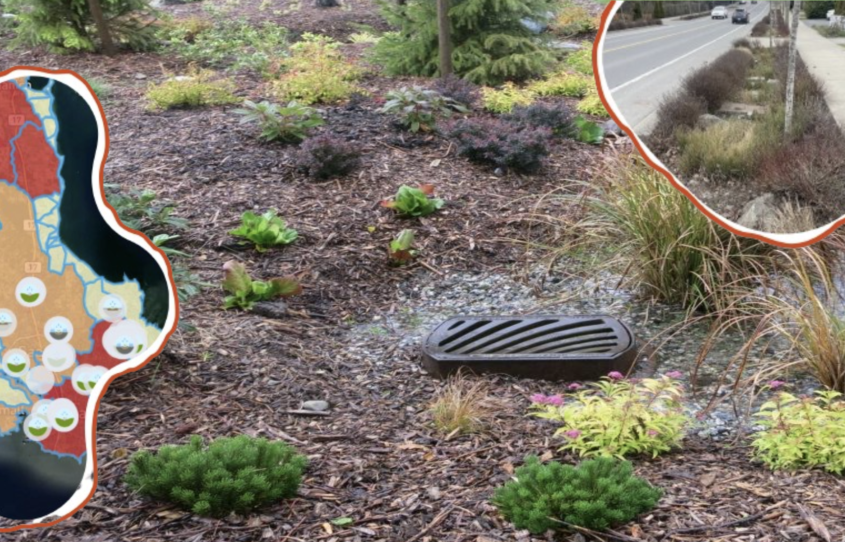
The natural filtration system sustainably recirculates stormwater runoff

Graphic by the Martlet. Photos courtesy of RUSH and via The Nature Trust of British Columbia.
The Resilient Urban Systems & Habitat (RUSH) Initiative, a collaboration between different local organizations, is leading a project to map 1 000 rain gardens on southern Vancouver Island.
Rain gardens are a landscape feature that lies at a lower level than its surroundings, designed to deal with stormwater runoff from impermeable surfaces like concrete. Instead of channeling this water directly into a drain, rain gardens allow it to reach deeper into the earth, replenishing groundwater reserves and enabling them to gradually enter creeks and waterways.
These gardens are an example of green infrastructure, typically consisting of a rock or gravel bed and wetland plants that specialize in filtration, such as reeds, grasses, and sometimes bulrushes. They are deliberately constructed in areas where management of stormwater is an issue — for example, beside roads and parking lots.
They also filter chemicals like 6PPD-quinone, an antidegradant used in tires, as well as other pollutants like those in cigarette butts out of stormwater runoff, preventing them from reaching the watershed where they can have a negative impact on fish and other aquatic life.
“[The] Victoria area and Oak Bay are all at risk of flooding because of a high degree of concrete — what’s called an impervious surface. The more impervious surfaces you have, the more you need rain gardens,” said Anne-Marie Daniel, Partner, Innovation at NatuR&D — the company that started the RUSH Initiative.
The initiative itself is a collaboration between many different organizations, including Peninsula Streams Society, the Friends of Bowker Creek Society, and the UVic Map Shop.
Rain gardens look like a depressed garden bed, typically with rocks and vegetation. Daniel said that many can be found near the Hillside Shopping Centre and Victoria International Airport, and that they are often included in new housing developments.
For the 1 000 Rain Gardens Project, the RUSH Initiative is encouraging schools in the southern Vancouver Island region to find rain gardens and map them on the RUSH website.
Victoria Drains is sponsoring the project by paying for pizza parties for any class that maps 20 or more rain gardens.
By mapping the rain gardens, the RUSH Initiative hopes to promote “rapid resilience in record time” by ensuring that community members have access to information about existing green infrastructure in their area, and highlighting areas where more gardens are needed.
“As I was doing all this volunteering … I didn’t have the information I needed to know what we could do around climate change, because I couldn’t get a sense of … what was needed,” said Daniel.
“We want to use the maps to motivate connected action so that people can observe, measure, and repeat actions that reliably result in resilience to climate change and in securing long term health.”
Daniel told the Martlet that users can enter their address on the RUSH Initiative’s website and find out whether their area is at risk for flooding, heat, or rising sea levels. That way, individuals can take action to build rain gardens and other green infrastructure in areas where they are needed. “We’re all about [solutions],” she said.
While mapping rain gardens is the current project, Daniel told the Martlet that RUSH plans to map more kinds of green infrastructure and community supports — including canopy coverage, food infrastructure, storm drains, safe bus stops, and public water fountains — as well as public and inclusive washrooms.
“[That’s] not so much about green infrastructure, but rather out of support for human dignity and everybody’s ability to access a drink or facilities as they need them,” she said.
The 1 000 Rain Gardens Project is ongoing, and more information can be found on RUSH’s website and NatuR&D’s instagram page.


